A beautiful hike in the Dandenong Ranges
An explosion of greenery. Gum trees, blackwoods and silver wattles as far as the eye can see. Giant ferns, sometimes several meters high. Cockatoos, parrots and lorikeets. The distinctive song of a kookaburra echoing between the trees. And in the middle, a path that goes deep into the forest. This is what awaits you in the Dandenong Ranges, less than an hour from Melbourne. Sounds tempting doesn’t it? So put your best shoes on and follow me for a beautiful hike on the Dandenong Ranges Loop Trail!
The Dandenong Ranges Loop Trail
Things to do in the Dandenong Ranges
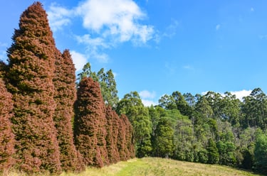
The Dandenong Ranges are a series of wooded hills approximatively 35 km east of Melbourne. The highest peak, Mount Dandenong, rises to an altitude of 633m. There are several pleasant villages in the region: Olinda, Emerald, Mount Dandenong… There are many things to do in the Dandenong Ranges. The most famous attraction is the Puffing Billy, an old heritage steam train which runs between Belgrave and Gembrook. But this region is also ideal for all those who like to walk in the forest. One hike in particular will give you a good overview of its beauty: the Dandenong Ranges Loop Trail.

Hiking the Dandenong Ranges Loop Trail
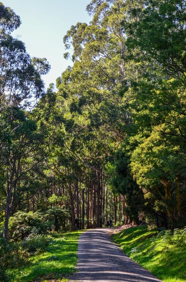
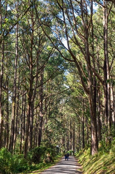
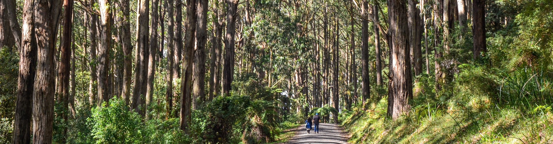
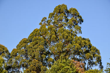
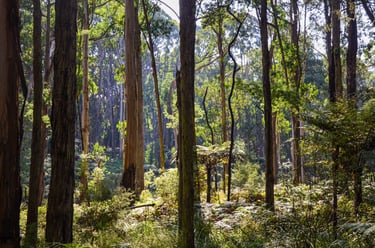
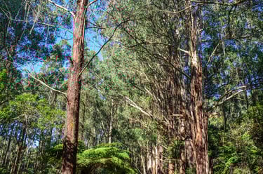
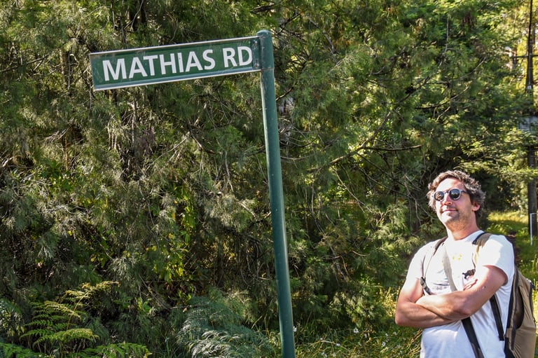
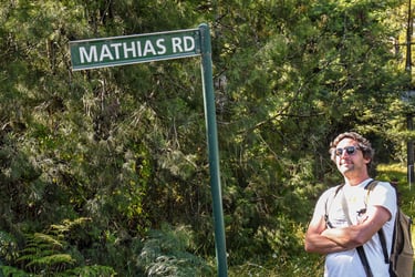
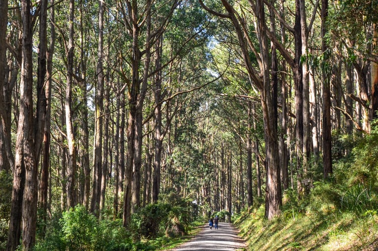
The starting point of the hike is in Olinda, close to the Dandenong Ranges Botanic Gardens. It begins on the Mathias Walking Track, a wide path surrounded by very tall eucalyptus trees. I don't know how high these ones are, but some in the Dandenong Ranges rise over 80m! They can be found mostly around Sassafras Creek, a little further south.
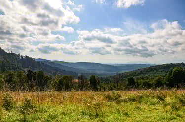
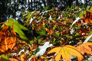
The trail remains relatively flat until the RJ Hamer Arboretum. This ‘tree garden’ is home to more than 150 species, both native and exotic, such as Japanese Cedars or maple trees. The colours in autumn are absolutely stunning! I advise you to take a small detour from the the Mathias Track to climb up to Woolrich lookout. The view is clear from here and offers a beautiful perspective of the Dandenong Ranges.

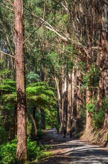
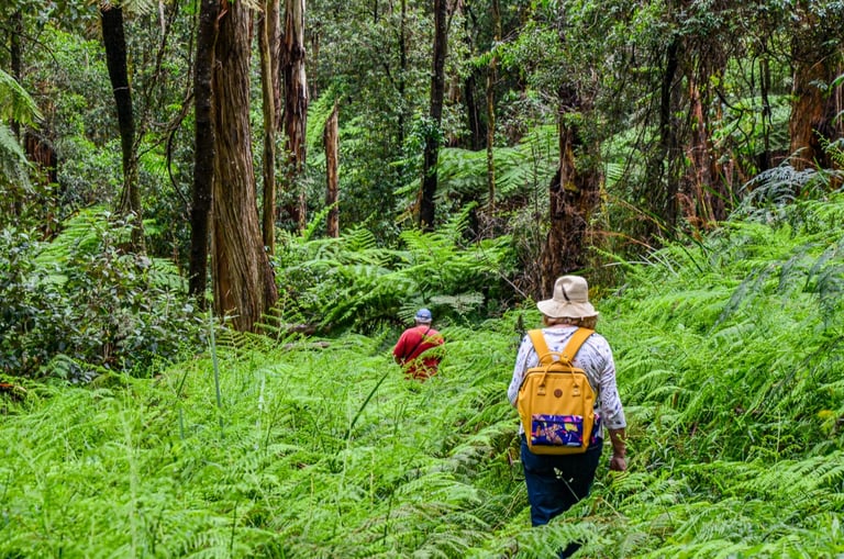
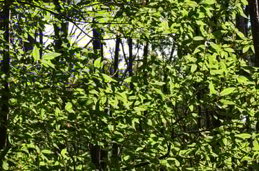
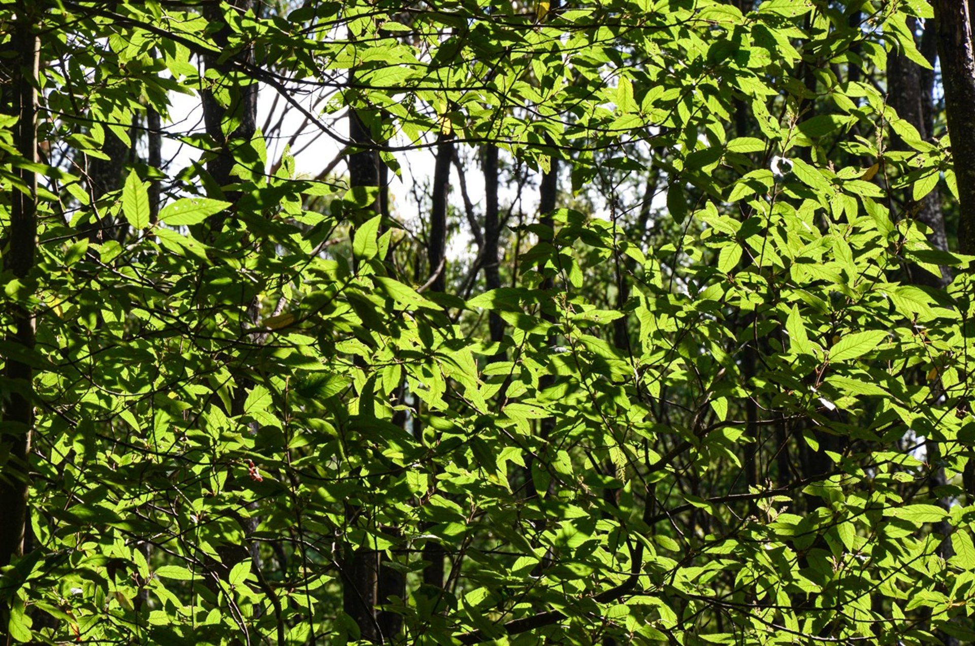
My favourite part of the hike begins just after the arboretum. As Mathias Track joins up with Silvan Road, turn left to take the narrow path going down. Turn right on Manna Gum Track a little further on then keep going straight. You’ll really be in the middle of the forest on this section of the hike. At some point you’ll even cross a real field of ferns, particularly photogenic!

At the very bottom of this descent, the hike makes a fairly long loop through the forest. You can easily take a shortcut if you don't want to do the entire path. Finally, the last climb (not difficult but a little long after a while) will take you back to the starting point via Barges Track, then Bartlett Road and finally Predator Track.


Things to know before your hike
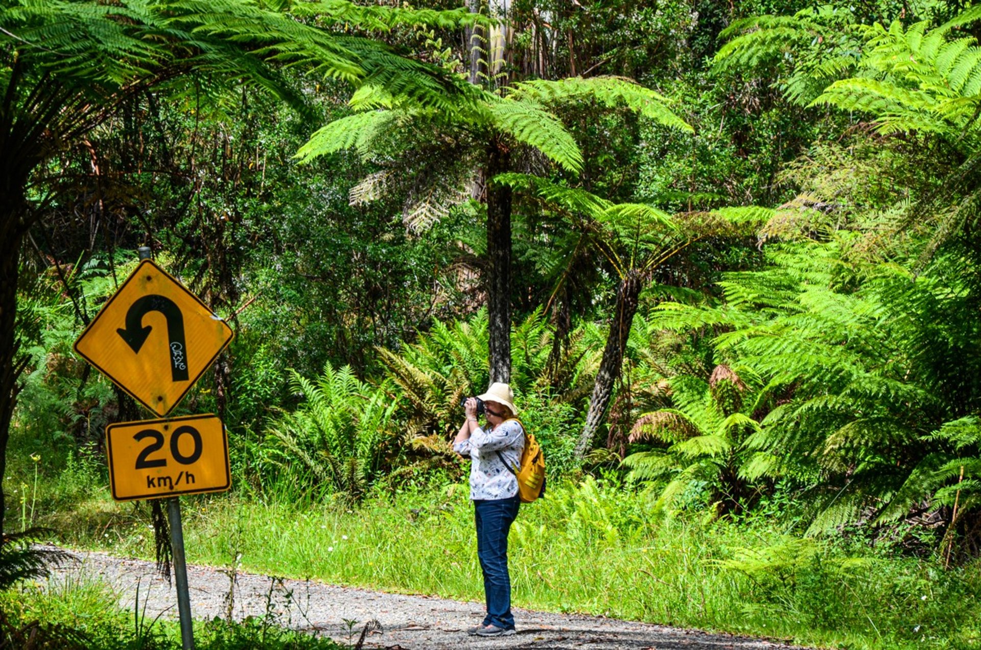
The Dandenong Ranges Loop Trail is a hike of moderate difficulty, accessible to all. The entire track measures approximately 12km, a little more if you take the detour to Woolrich lookout. But there are a lot of paths in the forest so you can easily take a shortcut to reduce the length (make sure to have a good map though so you don’t get lost). The elevation gain is almost 400m, but mostly on regular and not very steep climbs. No particular danger to note, except the presence of numerous leeches in the vegetation when the weather is humid. Wear pants rather than shorts! For more details, have a look at the profile of the hike on AllTrails.com (free registration).
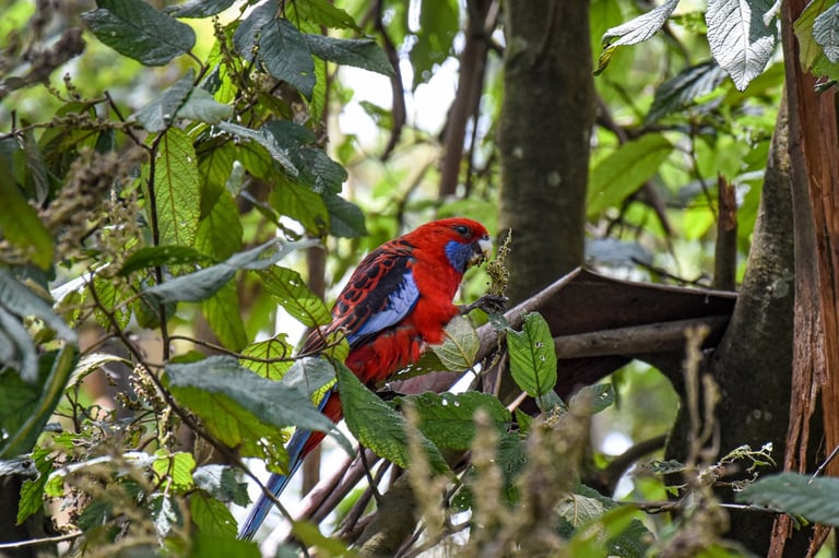

The Dandenong Ranges are home to a lot of wildlife. During this hike you may come across an echidna, a wombat or a hind. You’ll also very likely see a lot of birds: cockatoos, lorikeets, parrots, or kookaburras. If you’re very lucky, you might even spot a lyrebird. This bird owes its name to its long tail, whose S shape is reminiscent of a lyre. It also has a rather incredible ability, that of being able to perfectly imitate the songs of dozens of other birds, and even human sounds like a car alarm or a chainsaw! Here’s a video about the lyrebird taken from a David Attenborough's documentary.

Getting there
Olinda is about an hour’s drive from the CBD of Melbourne. Take the Monash Freeway (M1) towards the south-east, then take exit 11 to Ferntree Gully Road (State Route 22). After about 12km, turn right on Burwood Highway (State Route 26), then 3.5 km further turn left in the direction of Olinda on Mount Dandenong Tourist Road. Once in Olinda, follow the traffic sign towards the Dandenong Ranges Botanic Gardens on the right, then take the first left. Drive past the entrance of the botanic gardens and keep straight on Falls Road, a dirt road winding through the forest. After about 1.5 km, you will see a small parking lot on your right. This is the beginning of the Mathias Walking Track.
You can also take public transport. In that case, you will have two possibilities:
first option, take the Belgrave train line until Upper Ferntree Gully, then the bus 688 towards Croydon. Get off at the stop Ridge Road/Mt Dandenong Tourist Road;
second option, take the Lilydale train line until Croydon, then the same bus 688 but in the opposite direction, towards Upper Ferntree Gully. Get off at the same stop.
In both cases, you’ll still have to walk about 1.5 km to the starting point of the hike.

Large parts of Victoria can be prone to bushfire during summer. Always check the conditions on Vic Emergency before you go.
Do you know any other beautiful hike in the Dandenong Ranges? Send me a message to let me know!
Acknowledgment of country
I respectfully acknowledge the Traditional Owners of the land where Naarm/Melbourne is located, the Wurundjeri Woi-wurrung and Bunurong / Boon Wurrung peoples of the Kulin Nation, and pay respect to their Elders, past and present.


Follow me on social media!
©2025 by Inside my Melbourne - All rights reserved
A question, a suggestion or anything you'd like to tell me? Use the link below to contact me!